ArcGIS Maps for Adobe Creative Cloud allows you to create and design map artwork using your own data as well as public content from ArcGIS Online, including ArcGIS Living Atlas of the World. As a user of the extension and any public data, you agree to certain terms and conditions of use, including but not limited to what is listed below.
Read the master agreement and full terms of use.
Free accounts (using the 21-day trial) permit using the extension with the map data provided through ArcGIS Online for personal use only.
For other licensed accounts, the following uses are permitted:
- Personal use, internal business use, or to include in presentations or reports for a client
- In brochures and marketing collateral, or on a business website to promote your products and services and display store locations
- In academic publications such as research journals and textbooks
- In government works (so long as the agency delineates between government works that are in the public domain and third-party works that are protected by copyright)
Nota:
Commercial use of data for certain countries and regions may be subject to additional third-party restrictions.
For other uses, such as commercially monetizing the data or direct resale, you must first obtain permission from Esri by contacting our Contracts Department. (You can also contact them if you want to confirm that your planned use is permitted.)
The cloud-hosted ArcGIS maps and layers that you can access with the extension are created, maintained, and shared by Esri and third-party data providers such as business partners, distributors, and the user community. To use this map data in your designs, in addition to complying with the master agreement linked above, you must review individual terms of use per data item to ensure compliance with the data provider as well.
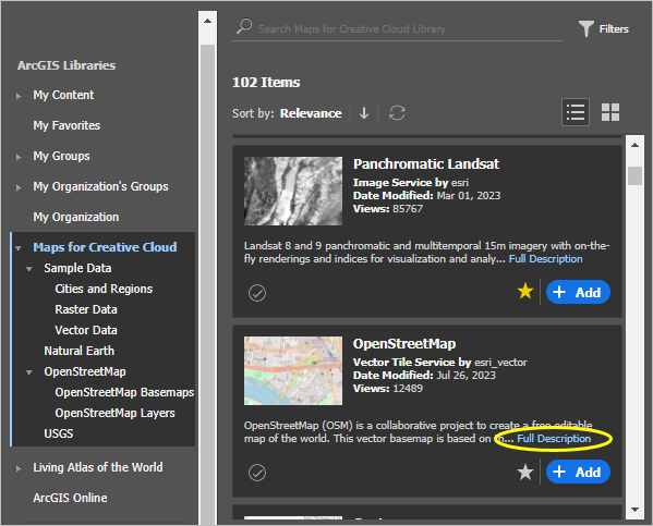
When browsing ArcGIS content, you can access the Terms of Use information for each specific dataset (as well as other data details) by selecting a map item and clicking the Full Description link.

Sugerencia:
In many cases, data from the user community is contributed by individuals. As with any peer-to-peer sharing platform, always research to ensure that the data is valid and appropriate for your intended design.
You may include static representations of the map data in hard-copy or electronic format in presentation packages, marketing studies, or other reports or documents as map images or data summaries derived from the use of ArcGIS Maps for Adobe Creative Cloud subject to any restrictions stated in the master agreement and provided that you affix an attribution statement crediting the data source.
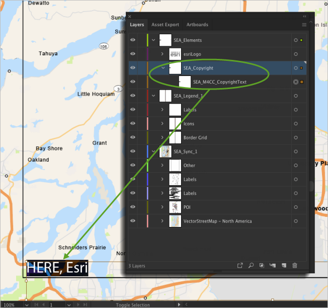
Regardless of your account type, in all cases, your use of map designs created from ArcGIS maps must include appropriate attribution to Esri and its licensors. For more information about crediting data providers in your output designs, see Display copyrights. The required attribution note must list the data providers using the text that appears in the applicable layers in Adobe Illustrator. For example, use the text from the *_Copyright layer included when you download (sync) maps as artwork or Other when you open .aix files for maps exported from ArcGIS Pro. However, you can design the note and position it anywhere on your map artwork (or associated metadata) to match the overall aesthetic of your design.
